File:RKRR Sector Map.png
No higher resolution available.
RKRR_Sector_Map.png (484 × 548 pixels, file size: 492 KB, MIME type: image/png)
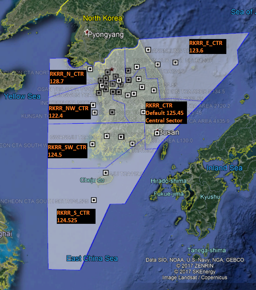
FIR Map with frequencies and airspace delegation
File history
Click on a date/time to view the file as it appeared at that time.
| Date/Time | Thumbnail | Dimensions | User | Comment | |
|---|---|---|---|---|---|
| current | 09:00, 10 November 2018 | | 484 × 548 (492 KB) | 107880 (talk | contribs) | Changed / 10, Nov 2018 |
| 16:49, 25 October 2017 |  | 820 × 929 (971 KB) | 313828 (talk | contribs) | FIR Map with frequencies and airspace delegation |
- You cannot overwrite this file.
File usage
The following page links to this file: